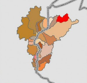
 A quick orientation: The map to the left shows the state boundaries between Wisconsin and Minnesota (dotted line) with the western end of Lake Superior shown at the top. The mighty St. Croix River drains a vast area (roughly the shape of Africa) of western Wisconsin and eastern Minnesota. The source of this river is in the headwaters area or watershed shown in red.
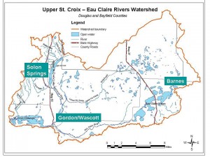
This red area is called the Upper St. Croix – Eau Claire Rivers Watershed, shown in the map below. Note: the word watershed is simply the scientific term for the land area drained by a river, in this case the headwaters of the St. Croix River. This area is the historic focus of the Friends of the St. Croix Headwaters organization.


